Beyond Maps: The Rise of Spatial Computing
The contemporary urban environment is increasingly mediated by layers of digital information, a phenomenon fundamentally altering pedestrian navigation. Traditional cartography, constrained by its two-dimensional representation, is yielding to the immersive potential of augmented reality (AR). This transition marks a significant shift from static wayfinding to dynamic, context-aware exploration.
Spatial computing, the technological foundation of modern AR, enables digital content to be anchored to and interact with physical space in real-time. By leveraging advances in simultaneous localization and mapping (SLAM) and depth sensing, applications can precisely overlay directions, points of interest, and historical data onto a live camera feed. This synthesis creates a hybrid experience where the city itself becomes the interface.
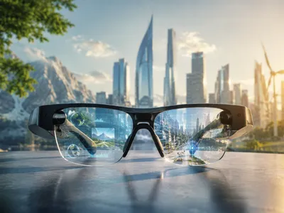
The cognitive impact of AR in urban settings is profound. Instead of mentally aligning maps with their surroundings, users receive intuitive visual cues directly in their field of view, reducing cognitive load and allowing deeper engagement with the city itself. Wearable technologies like optical see-through displays and the gradual evolution of smart glasses promise persistent, hands-free spatial computing. AR also enables selective presentation of geolocated information, turning users into active explorers who can uncover hidden narratives, from architectural histories to social dynamics. In this way, the map transforms into a live, adaptive system that responds to position, gaze, and intent, shifting urban navigation from static representation to dynamic, context-aware interaction.
How Does AR Filter the Urban Environment?
Augmented reality applications function as sophisticated filters, selectively superimposing digital data onto the physical world to enhance comprehension and interaction. This process relies on a complex interplay of hardware and software to seamlessly integrate virtual content. The primary challenge lies in ensuring that this digital layer remains stable, contextually relevant, and unobtrusive to the user's natural perception.
At the core of this filtering mechanism is the ability to perform precise environmental understanding. Modern AR frameworks utilize a combination of camera input, inertial measurement units (IMUs), and advanced computer vision algorithms to construct a real-time 3D map of the surroundings. This map enables the application to accurately place virtual objects, from directional arrows pointing toward a landmark to informational placards hovering above a building, making them appear rooted in physical reality.
Different types of digital overlays serve distinct navigational and exploratory purposes. The following table outlines common categories of AR content designed to enrich the city exploration experience, each leveraging spatial computing in a unique way.
| Overlay Type | Primary Function | User Experience |
|---|---|---|
| Informational | Displays data on points of interest (POIs). | Enables discovery of nearby amenities, ratings, and hours. |
| Navigational | Projects paths and directional cues onto the street. | Reduces cognitive load by aligning guidance with the user's view. |
| Historical | Reconstructs past events or buildings at their original sites. | Offers an immersive educational layer, connecting past and present. |
| Social | Shows user-generated content, like reviews or photos. | Fosters a collective urban narrative and community engagement. |
The effectiveness of these filters hinges on the accuracy and responsiveness of the underlying technology. A critical component is the semantic understanding of space, where the system not only knows the geometry of a location but also recognizes objects like doors, benches, or street signs. This intelligence allows for more iintelligent augmentation, such as directions that say "enter the door to your left" rather than a simple directional arrow, creating a more intuitive and helpful guidance system.
To achieve this level of contextual awareness, AR navigation apps integrate data from multiple sources. The following list details the key technological pillars that enable the seamless filtering of the urban environment.
- Computer Vision & SLAM Core
- Sensor Fusion (GPS, IMU, Magnetometer) Essential
- 5G and Edge Computing Emerging
- Cloud-based Spatial Anchors Infrastructure
The implications of this sophisticated filtering extend beyond mere convenience, raising questions about digital sovereignty and the privatization of public space. When a corporation controls the primary lens through which a city is experienced, the potential for curated, commercially-driven narratives becomes significant. The challenge for urban planners and technologists is to ensure that these filters remain open and diverse, supporting a pluralistic view of the city rather than a single, authored perspective.
Navigating Complexity
Urban environments are filled with constantly changing variables, from shifting pedestrian traffic to temporary architectural obstacles. Navigating such complexity requires more than simple directions; it demands systems capable of contextual adaptation. Augmented reality applications can address this challenge by processing real-time environmental data and adjusting guidance dynamically. The integration of predictive analytics further enhances these tools by analyzing historical movement patterns and current crowd density to suggest alternative routes or highlight timely points of interest. Combined with real-time semantic mapping, modern AR navigation systems can recognize disruptions such as construction zones, public events, or sudden weather changes and instantly recalculate safer and more efficient pathways.
The user's cognitive and perceptual load during navigation is a critical factor in the design of effective AR interfaces. Information density must be carefully calibrated to avoid overwhelming the user with visual clutter, a phenomenon often referred to as cognitive tunneling. Research suggests that minimalist, gesture-based interactions and audio cues can complement visual overlays, distributing the sensory load and creating a more intuitive and less taxing navigational experience. The ultimate goal is to create an interface that feels like an extension of the user's own perceptual system.
Different navigational scenarios demand distinct informational priorities. A tourist exploring a historic district has vastly different needs than a resident commuting to work. Modern AR applications are beginning to address this diversity by offering customizable layers of information. The following list illustrates the spectrum of navigational priorities that these systems must accommodate, ranging from basic orientation to deep contextual exploration.
- Orientation & Wayfinding: Basic directional cues and path planning.
- Safety & Accessibility: Highlighting hazards, accessible routes, and well-lit paths.
- Temporal Information: Real-time updates on transit schedules, wait times, and events.
- Social & Cultural Cues: Displaying reviews, historical anecdotes, and community-generated content.
From Wayfinding to Urban Engagement
The evolution of AR navigation marks a transition from mere wayfinding—the functional task of moving from point A to point B—to a richer concept of urban engagement. This shift positions the technology as a tool for placemaking, where digital augmentation can foster a deeper connection between individuals and their surroundings. The city becomes a canvas for interactive storytelling and experiential learning.
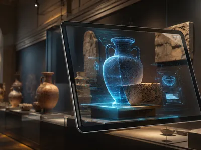
By overlaying historical imagery, archival documents, and narratives directly onto contemporary streetscapes, AR applications transform urban exploration into a dialogue with the past. A user standing in a modern square can witness its historical significance through recreatd scenes, fostering a sense of continuity and collective memory. This educational potential extends beyond history to include ecological, sociological, and architectural dimensions of the urban fabric.
This enhanced engagement also cultivates serendipitous discovery, a quality often lost in optimized, point-to-point navigation. When applications highlight hidden gems, local art installations, or impromptu street performances, they encourage deviation from planned routes. This fosters a more playful and exploratory relationship with the city, turning routine commutes into opportunities for novel experiences. The technology, therefore, acts as a catalyst for a more vibrant and participatory urban culture.
The potential applications for fostering urban engagement through AR are vast and varied. The table below categorizes different modes of interaction that move beyond simple navigation, illustrating how these tools can enrich the citizen's relationship with their environment.
| Engagement Mode | Description | Example Application |
|---|---|---|
| Historical Reconstruction | Visualizing past states of a location. | Viewing a historical building as it stood 100 years ago. |
| Narrative Layering | Adding stories and personal accounts to places. | Listening to oral histories while standing at a relevant site. |
| Gamified Exploration | Turning city discovery into an interactive game. | Geocaching or AR scavenger hunts that reveal local lore. |
| Social Annotation | Allowing users to leave digital notes or art. | Public AR murals or community message boards in space. |
However, this transition from wayfinding to engagement is not without its challenges. The creation of compelling, accurate, and inclusive digital content requires significant collaboration between technologists, urban planners, historians, and local communities. If left solely to commercial interests, these augmented layers risk becoming homogenized, promoting a commodified view of the city that prioritizes consumerism over civic identity. Ensuring that these tools empower diverse voices and foster genuine community connection is paramount for the healthy evolution of the augmented city.
Looking ahead, the integration of social features into these platforms can further deepen urban engagement. Imagine leaving a digital "note" for a friend at a favorite cafe or participating in a city-wide AR-based public art project. These shared, location-based experiences have the potential to build social cohesion and transform public spaces into dynamic arenas for collective creativity and interaction, fundamentally reshaping what it means to be an active citizen in a digitally mediated world.
Charting the Future of Civic Exploration
The trajectory of augmented reality in urban environments points toward a future where the very concept of civic exploration is fundamentally reimagined. As spatial computing infrastructures mature, the distinction between digital information and physical reality will continue to blur, creating persistent, location-based experiences that are shared across communities. This evolution promises to transform how citizens interact with municipal services, cultural institutions, and each other within the public realm.
Emerging developments in digital twin technology and urban data platforms will provide the foundational architecture for this next generation of civic tools. By synchronizing real-time city data—from air quality sensors to public transit feeds—with high-fidelity 3D models, AR applications can offer citizens unprecedented situational awareness and participatory agency. The following areas represent critical frontiers for development as we consider the responsible and equitable expansion of augmented civic spaces.
- 1. Persistent Spatial Anchoring: Ensuring digital content remains accurately fixed to locations over time and across different users' devices, creating a stable shared layer.
- 2. Decentralized Data Governance: Developing protocols for user-owned data and community-controlled public digital spaces to prevent corporate monopolization.
- 3. Accessibility and Inclusivity: Designing interfaces that accommodate diverse cognitive and physical abilities, ensuring the augmented city is navigable by all.
- 4. Contextual Content Moderation: Creating frameworks to manage misinformation, hate speech, and digital vandalism in location-based public layers.
- 5. Interoperability Standards: Establishing common protocols so that AR experiences are not confined to single platforms or proprietary ecosystems.
Addressing these developmental frontiers will be essential for harnessing the full potential of AR as a tool for democratic engagement and collective intelligence. The capacity for citizens to visualize proposed urban developments, participate in participatory budgeting anchored to specific locations, or contribute to community-driven historical archives represents a significant expansion of civic agency. However, this promise is tempered by the risk of creating new digital divides and surveillance infrastructures if ethical frameworks do not keep pace with technological capability.
The future of civic exploration, therefore, hinges not merely on technical innovation but on deliberate, inclusive governance of the augmented public realm. The challenge lies in cultivating digital layers that amplify human connection and civic discourse rather than fragmenting them through algorithmic curation and commercial interests. Ultimately, the most successful AR cities will be those that empower their inhabitants to become active co-authors of their shared, augmented reality.