Reading the Rock Record
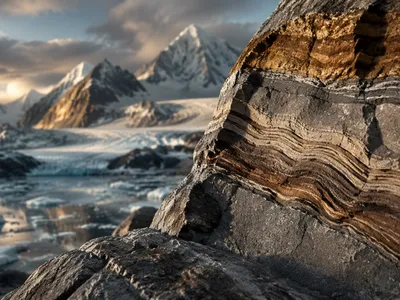
The Earth's crust functions as a dynamic archive, preserving a complex narrative within its stratified layers. Geologists decipher this story by applying a rigorous methodological framework to lithostratigraphic and chronostratigraphic units. Each stratum represents a distinct depositional environment, locking in chemical and physical signatures from its time of formation.
These signatures are not merely passive markers but active records of planetary processes. The composition of a sandstone, for instance, reveals its source terrain's tectonic setting and climate. Igneous intrusions cross-cutting sedimentary beds provide relative age constraints, while metamorphic textures whisper tales of mountain-building events deep in the past.
Interpreting this record requires understanding the fundamental difference between relative and absolute dating. The former establishes the sequence of events, while the latter assigns numerical ages. This dual approach transforms random rock observations into a coherent, four-dimensional history, moving beyond simple description to process-oriented analysis of Earth's evolution.
The Principles of Decipherment
Stratigraphic analysis rests upon foundational laws established during geology's formative period. Superposition dictates that in an undeformed sequence, the oldest layers lie at the bottom. Original horizontality posits that sediments are deposited in roughly horizontal sheets, so tilted strata indicate post-depositional deformation. These principles allow for the reconstruction of geological sequences from local outcrops.
The principle of lateral continuity suggests that a layer extends continuously until it thins out or meets a barrier, enabling correlation between separated exposures. Perhaps most powerful is the law of cross-cutting relationships, which states that any geologic feature cutting across another must be younger. This logic applies to faults, dikes, and unconformities, providing a clear sequence of events.
An unconformity, a surface of erosion or non-deposition, represents a significant gap in the rock record—a missing chapter. Identifying these hiatuses is crucial, as they often mark periods of major tectonic uplift or sea-level fall. The angular unconformity, where stratified rocks lie atop tilted, eroded layers, is a classic indicator of a profound tectonic episode.
The following table summarizes the core stratigraphic principles and their primary utility in geological interpretation.
| Principle | Core Concept | Primary Application |
|---|---|---|
| Superposition | Younger layers overlie older ones in undisturbed sequences. | Determining relative age sequence in sedimentary and volcanic stacks. |
| Original Horizontality | Strata are deposited horizontally; tilting is subsequent. | Recognizing post-depositional deformation events. |
| Lateral Continuity | Layers extend laterally until they pinch out or meet a barrier. | Correlating rock units across distance in basin analysis. |
| Cross-Cutting Relationships | A feature cutting another is younger. | Sequencing igneous intrusions, faults, and unconformities. |
Beyond these classical laws, modern stratigraphy incorporates Walther's Law of Facies, which links vertical rock sequences to lateral environmental shifts. This principle is indispensable for interpreting transgressive and regressive marine sequences driven by sea-level change. It bridges observable rock characteristics with paleogeographic reconstructions.
- Unconformities (nonconformity, angular unconformity, disconformity) signify major hiatuses and tectonic events.
- Walther's Law connects vertical stratigraphic successions to lateral depositional environment changes.
- Sequence stratigraphy uses bounding surfaces and facies patterns to track base-level cycles.
- Biostratigraphy utilizes fossil assemblages to define zones for precise correlation.
Fossils as Windows to the Past
Beyond simple curiosities, fossils are critical data points that constrain the timing and environment of ancient strata. Biostratigraphy leverages the irreversible evolution and extinction of species to define unique, global time intervals called biozones. The first appearance datum of a widespread, rapidly evolving species provides one of the most precise correlation tools available to geologists.
The taphonomic processes that govern fossil preservation introduce a significant filter on the biological record. Organisms with hard parts in low-energy, anoxic environments fossilize best, creating a biased sample of past life. Despite this, exceptional preservation in Lagerstätten deposits offers unparalleled glimpses of soft-tissue anatomy and ecological relationships, revealing otherwise invisible chapters of evolutionary history.
Fossil assemblages are potent paleoenvironmental indicators. The presence of certain foraminifera species can pinpoint ancient water depths and temperatures with remarkable accuracy. Coral reef complexes indicate warm, shallow seas, while glacial tillites containing striated boulders are the definitive signature of past ice ages. These proxies transform static rock layers into dynamic snapshots of Earth's past climates and geographies.
The table below categorizes major fossil types and their primary significance in geological interpretation, highlighting their dual role as chronological and paleoecological tools.
| Fossil Type | Key Characteristics | Geological Utility |
|---|---|---|
| Index Fossils | Wide geographic range, short temporal range, abundant. | High-precision correlation and biozone definition. |
| Trace Fossils (Ichnofossils) | Preserved behavior (burrows, tracks, borings). | Indicators of substrate consistency, water energy, and organism behavior. |
| Microfossils | Microscopic (e.g., forams, conodonts, pollen). | Excellent for biostratigraphy and isotopic analysis; abundant in drill cores. |
| Macrofossils | Large, visible remains (e.g., shells, bones, leaves). | Paleoecological reconstruction and broader biostratigraphic zonation. |
What Do Isotopes Tell Us?
Isotopic systems provide a quantitative and absolute chronometer, moving geological history from a relative sequence to a calibrated timeline. Radiometric dating relies on the predictable decay of unstable parent isotopes into stable daughter products. The ratio of parent to daughter isotopes in a mineral crystal, which forms a closed system at a specific temperature, yields a numerical age since its crystallization or resetting.
Different isotopic systems have distinct closure ttemperatures and half-lives, making them suitable for different materials and timescales. Uranium-Lead dating in zircon crystals, with its exceptionally high closure temperature and dual decay chains, provides the most robust dates for ancient igneous and metamorphic events. In contrast, Carbon-14 dating is restricted to very young organic materials due to its short half-life.
Beyond geochronology, stable isotope ratios act as powerful environmental proxies. The ratio of oxygen-18 to oxygen-16 in carbonate shells or ice cores is a classic paleothermometer, reflecting ancient ocean temperatures and global ice volume. Strontium isotope ratios in marine sediments track continental weathering inputs and have produced a high-resolution curve used for global correlation throughout the Phanerozoic.
The application of these techniques is summarized in the following table, which outlines common isotopic systems and their primary applications in geologic research.
| Isotopic System | Half-Life (Years) | Common Mineral/Material | Primary Application |
|---|---|---|---|
| Uranium-238 to Lead-206 | 4.47 billion | Zircon, Baddeleyite | Dating ancient igneous and metamorphic rocks (>1 Ma). |
| Potassium-40 to Argon-40 | 1.25 billion | Feldspar, Mica | Dating volcanic rocks and metamorphic cooling events. |
| Rubidium-87 to Strontium-87 | 48.8 billion | Mica, Whole Rock | Dating igneous and metamorphic rocks; crustal evolution. |
| Carbon-14 to Nitrogen-14 | 5,730 | Organic Carbon, Carbonates | Dating very young (<50,000 yr) organic materials. |
Unraveling the Tectonic Tapestry of Deep Time
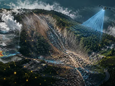
The continents beneath our feet are not static platforms but dynamic fragments in perpetual, slow-motion motion. This grand narrative of plate tectonics is deciphered from the geological record through a confluence of rock magnetism, structural deformation, and the distribution of ancient life. Continental collisions forge mountain belts, while rifting creates new ocean basins, with each process leaving a distinct signature in the crust.
Paleomagnetism provides one of the most compelling lines of evidence for plate movement. As iron-bearing minerals in volcanic rocks cool, they align with Earth's magnetic field, preserving a record of the rock's latitude at the time of formation. Measurements from successive rock layers reveal apparent polar wander paths, which are best explained by the continents themselves drifting across the globe over hundreds of millions of years.
Orogenic belts—the eroded roots of ancient mountain ranges—tell the story of continental collisions. The intense folding, thrust faulting, and regional metamorphism observed in these zones are the direct result of crustal shortening and thickening. The presence of high-pressure, low-temperature metamorphic minerals like glaucophane signals past subduction zones, marking where oceanic plates vanished into the mantle.
The field of paleobiogeography offers a biological testament to continental motions. The discovery of nearly identical fossil species in sedimentary rocks now separated by vast oceans, such as the Triassic reptile *Lystrosaurus* found in Africa, India, and Antarctica, provides undeniable proof that these landmasses were once amalgamated into the supercontinent Pangaea. These organisms could not have crossed deep ocean barriers, leaving continental connection as the only viable explanation.
The assembly and breakup of supercontinents like Rodinia and Pangaea are chronicled through the correlation of these diverse proxies. Matching the age and structural trends of mountain belts on different continents, like the Appalachian range of North America with the Caledonides of Scandinavia, stitches together ancient continental margins. Simultaneously, the timing of rift-related volcanic provinces and the opening of new ocean basins are dated using radiometric techniques on basaltic layers, creating a precise chronology of fragmentation. This synthesis of paleomagnetic, paleontological, and structural data allows geologists to create animated plate reconstructions that chart the dance of continents through deep time.
Understanding this tectonic tapestry is not merely an academic exercise; it is fundamental to explaining the distribution of Earth's natural resources. Major metallogenic provinces, containing world-class deposits of copper, gold, and silver, are directly associated with specific plate tectonic settings, such as ancient volcanic arcs or continental rift zones. The formation and preservation of hydrocarbon resources in sedimentary basins are also governed by the subsidence history and thermal regime of the basin, which are tectonic processes. Therefore, reconstructing past plate configurations provides a powerful predictive framework for resource exploration, linking the geological processes of the past to the economic geography of the present.
- Paleomagnetism in volcanic rocks records the latitude of a continent at the time of formation, proving lateral movement.
- Correlating the age and style of ancient mountain belts (orogens) on separate continents reveals their past connections.
- The distribution of unique fossil species across now-disparate landmasses provides biological evidence for supercontinents.
- The geochemical signature of igneous rocks acts as a fingerprint for their tectonic setting of origin (e.g., mid-ocean ridge, island arc).
Earth's Story in a Single Grain
The most comprehensive chronicles of Earth's history are often contained within microscopic mineral grains. Through advanced analytical techniques, geologists extract a wealth of information from individual crystals, transforming them into multi-dimensional data points that constrain time, temperature, pressure, and chemical environment. A single grain of zircon, for instance, can survive multiple cycles of erosion and metamorphism, preserving a layered isotopic record of each event it has witnessed.
Microanalysis allows for the deconstruction of a mineral's complex history. Cathodoluminescence and backscattered electron imaging reveal internal growth zones within crystals. Targeted in-situ analysis, such as laser-ablation mass spectrmetry, can then probe the isotopic composition of each zone individually. This approach can distinguish the primary magmatic signature of a crystal's core from the overprinting effects of a later metamorphic event recorded in its rim.
The application of multiple geochronometers to a single sample, known as paired chronology, is particularly powerful. Analyzing the uranium-lead system in zircon for crystallization age while simultaneously measuring the lutetium-hafnium or samarium-neodymium systems in the same grain provides information about the source of the magma from which it crystallized. This reveals not just when a crust formed, but also from what reservoir it was derived, tracing the evolution of Earth's mantle and crust through time.
Beyond absolute dating, the trace element composition of individual grains serves as a sensitive geochemical fingerprint. The concentration of elements like yttrium, niobium, and the rare earth elements in a mineral is governed by the specific physical and chemical conditions present during its formation. These micro-scale signatures are used to discriminate between tectonic settings, such as a continental collision zone versus an oceanic island arc, with a high degree of certainty, adding a critical layer of environmental context to the temporal framework provided by isotopic dating.
The convergence of these micro-scale techniques represents the forefront of historical geology. By integrating U-Pb geochronology, Lu-Hf isotope tracing, and trace element geochemistry from populations of individual detrital zircons found in sedimentary basins, geologists can now reconstruct the entire history of continental erosion and sediment routing. This methodology, called detrital zircon provenance analysis, identifies the specific ancient mountain ranges that sourced the sediment, even after those mountains have long since eroded away. It effectively allows scientists to see vanished landscapes and map the paleogeography of watersheds that ceased to exist hundreds of millions of years ago, writing history from grains of sand.