A Fragile Stratospheric Giant
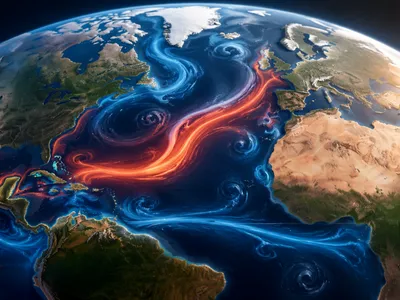
The stratospheric polar vortex is a massive, persistent cyclonic circulation that forms over the Arctic during winter. Its strength, defined by the zonal mean wind at 60°N, determines the confinement of frigid air to high latitudes.
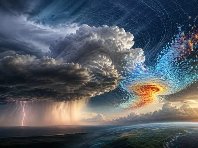
This dynamical system exhibits remarkable variability, yet its integrity is inherently precarious. Sudden stratospheric warmings (SSWs) represent the most dramatic disruption, often triggering a reversal of the zonal winds from westerly to easterly within days.
Such events are not merely isolated atmospheric curiosities; they fundamentally reconfigure the stratospheric waveguide, altering the propagation of planetary waves. When the vortex weakens, it loses its ability to contain the polar air mass, permitting a cascade of energy downward into the troposphere. This vertical coupling, mediated by changes in the refractive index for Rossby waves, can induce persistent negative phases of the Arctic Oscillation at the surface, offering valuable atmospheric science insights into weather extremes.
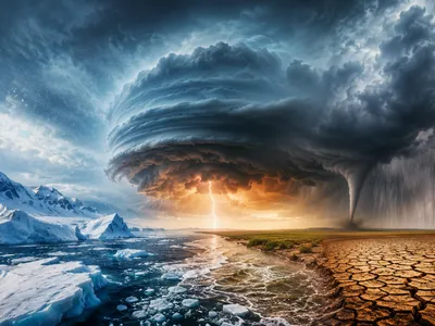
The resultant atmospheric blocking patterns, particularly over the North Atlantic and Siberia, act as a critical conduit for cold-air outbreaks. The resulting configuration often establishes a high-latitude anticyclone that funnels arctic air masses into mid-latitude regions, leading to prolonged periods of extreme cold that defy simple thermodynamic explanations based solely on mean warming trends.
Several diagnostic metrics capture the state of this high-altitude system. The following indicators are central to operational forecasting and retrospective analysis.
- Polar Cap Geopotential Height Vortex Strength Proxy
- Zonal Mean Zonal Wind at 10 hPa SSW Definition Criterion
- Eliassen-Palm Flux Divergence Wave Driving Diagnostic
Displacement vs. Splitting: Two Pathways to Chaos
Not all stratospheric disruptions manifest identically; the vortex can undergo two fundamentally distinct types of breakdown. Displacement events involve a significant shift of the vortex off the pole, while splitting events fragment the single cyclonic structure into two or more daughter vortices.
The mechanistic differences carry profound implications for tropospheric weather patterns. A displacement typically results from enhanced planetary wave number one activity, creating a single, elongated vortex lobe that promotes a specific geographical pattern of cold anomalies. In contrast, splitting events arise from wave number two forcing, which bifurcates the vortex and often leads to more prolonged and geographically diffuse cold-air outbreaks across both North America and Eurasia.
The predictability horizon for surface impacts hinges on accurately distinguishing these pathways. Numerical ensemble systems often struggle with the inherently chaotic nature of the bifurcation process, yet recent diagnostic frameworks have improved the early identification of the splitting versus displacement precursor signals.
| Feature | Displacement Event | Splitting Event |
|---|---|---|
| Dominant Wave Forcing | Wave number 1 | Wave number 2 |
| Vortex Geometry | Single, off-pole lobe | Two or more distinct vortices |
| Typical Surface Impact | Regional cold anomaly | Widespread, prolonged cold |
| Predictability Signal | Moderate lead time | Higher uncertainty, longer impact |
Post-event analysis confirms that the mode of vortex breakdown exerts a stronger control on sub-seasonal forecast skill than the absolute magnitude of the warming itself. This insight has driven the development of new ensemble metrics designed to categorize events in real-time.
How a Warming Arctic Reshapes the Jet Stream
Arctic amplification—the accelerated warming of the high latitudes—reduces the equator-to-pole temperature gradient. This gradient serves as the fundamental energy source for the mid-latitude jet stream.
A diminished thermal contrast weakens the zonal wind shear, rendering the tropospheric polar jet more susceptible to large-amplitude meanders. These meanders, or Rossby waves, exhibit a tendency toward quasi-resonant amplification under specific background flow conditions.
The resulting waveguide configuration becomes less zonal and more meridionally elongated, allowing planetary waves to propagate more efficiently upward into the stratosphere. This altered vertical wave activity flux represents a critical mechanistic link: a wavier jet stream enhances the transfer of energy from the troposphere to the stratospheric polar vortex, thereby increasing the likelihood of sudden stratospheric warmings that subsequently feedback onto surface weather patterns.
Contemporary observational analyses reveal a statistically significant trend toward increased persistence of high-amplitude jet configurations during autumn and early winter. When combined with the background warming trend, this dynamical shift creates a counterintuitive scenario where mid-latitude cold extremes can paradoxically intensify even as global mean temperatures rise, because the atmospheric circulation itself becomes more prone to blocking episodes that advect polar air far southward.
Connecting Stratospheric Anomalies to Surface Weather
The stratospheric polar vortex does not act alone; its anomalies influence the lower atmosphere through stratosphere-troposphere coupling, mainly by altering planetary wave propagation and reshaping tropospheric circulation. When the vortex weakens or experiences sudden warming, these anomalies descend over one to three weeks, often appearing as a negative phase of the Arctic Oscillation with higher pressure over the Arctic and lowerr pressure across mid-latitudes.
A key indicator of this process is the refractive index for planetary waves, as changes in stratospheric winds modify wave paths and direct energy toward regions that strengthen blocking anticyclones. These systems act as persistent gates that redirect cold air from Siberia and the Canadian Archipelago into densely populated mid-latitude areas.
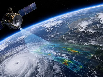
Advances in sub-seasonal forecasting now use this relationship, where predictions of SSWs and vortex changes provide lead times of two to four weeks for cold outbreaks. Forecasters now routinely monitor 10-hPa geopotential height and 100-hPa eddy heat flux anomalies, improving early warnings and reducing false alarms for extreme winter conditions, demonstrating clearly why meteorology improves weather prediction.
Unraveling Model Limitations and Emerging Insights
Despite substantial advances, operational forecast models still struggle to accurately represent the vertical coupling between the stratosphere and troposphere during sudden warming events.
A persistent limitation lies in the coarse vertical resolution near the tropopause layer, where the critical wave-mean flow interactions occur. Insufficient grid spacing can artificially dampen planetary wave propagation, delaying or even suppressing the downward influence of stratospheric anomalies in ensemble predictions.
Emerging high-top models with refined stratospheric resolution and improved gravity wave drag parameterizations now demonstrate enhanced skill in capturing the onset and evolution of sudden stratospheric warmings. These models reveal that the precise timing of wave-breaking events determines whether a vortex displacement or splitting will occur, a distinction that profoundly alters sub-seasonal forecast outcomes for mid-latitude cold extremes.
Process-based model evaluation has recently shifted from traditional error metrics to dynamical diagnostics such as the Eliassen-Palm flux divergence and the refractive index for planetary waves. This approach identifies systematic biases in how models represent wave-mean flow interactions, guiding targeted developments in physics parameterizations and providing a framework for assessing the next generation of seamless pprediction systems.
The following research priorities have emerged from recent intercomparison projects aimed at reducing forecast uncertainty in polar vortex dynamics.
- 1 Stratospheric initial condition refinement — enhancing data assimilation in the polar cap region above 10 hPa to better resolve precursor signals.
- 2 Wave-resolving model configurations — moving toward grid spacings that explicitly capture orographic and non-orographic gravity wave drag without excessive parameterization.
- 3 Probabilistic event classification — developing ensemble-based metrics that distinguish displacement, splitting, and stretching events in real-time for operational use.