The Thermodynamic Engine of Extremes
Atmospheric science identifies the fundamental physical laws governing weather extremes, primarily rooted in thermodynamics and fluid dynamics. The behavior of air masses, driven by energy imbalances, sets the stage for severe meteorological events.
The Clausius-Clapeyron relation dictates that a warmer atmosphere holds exponentially more water vapor. This relationship provides the essential fuel for intense precipitation and storms, creating a non-linear response to surface warming that amplifies extreme rainfall potential.
How Is Climate Change Altering the Atmospheric Baseline?
Anthropogenic climate change is not merely shifting average conditions but systematically distorting the probability distribution of daily weather. This shift increases the frequency and intensity of events in the distribution's tails.
The persistent thermodynamic forcing from greenhouse gases elevates the global available potential energy in the climate system. This elevated baseline ensures that natural weather patterns now operate in a fundamentally altered environment, where historical analogs become increasingly obsolete for predicting contemporary extremes. Anthropogenic forcing thus acts as a constant background signal upon which natural variability is superimposed.
The following table contrasts key characteristics of the pre-industrial atmospheric baseline with the current, altered state relevant for extreme event generation.
| Parameter | Pre-Industrial Baseline | Current Altered State |
|---|---|---|
| Lower Troposphere Heat Content | Relatively stable, lower mean | Substantially increased, rising mean |
| Global Saturation Vapor Pressure | Governed by natural variability | Enhanced by ~7% per °C warming |
| Pole-Equator Temperature Gradient | Stronger, more stable | Weakened, especially due to Arctic amplification |
| Extreme Event Probability Curve | Narrower distribution | Widened, fat-tailed distribution |
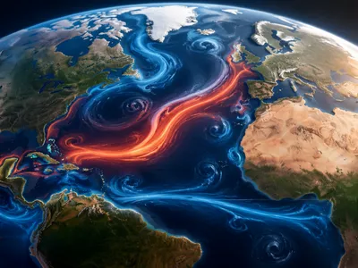
Jet Stream Dynamics and Persistent Weather
The behavior of the planet's high-altitude wind currents, particularly the polar jet stream, is a critical factor in the development of persistent and extreme weather patterns. These rivers of air, which steer weather systems, are themselves governed by fundamental atmospheric physics.
A key driver of the jet stream is the temperature gradient between the cold Arctic and warmer mid-latitudes. As anthropogenic warming disproportionately heats the Arctic—a phenomenon known as Arctic amplification—this gradient weakens. The rresulting decrease in the west-to-east wind speed allows the jet stream's waves to become larger and more sluggish.
When these meanders stall, they can establish semi-stationary blocking patterns that lock weather systems in place for days or weeks. An omega block, characterized by a high-pressure flanked by two lows, is a classic configuration that can induce simultaneous extremes: heat and drought under the persistent high, and flooding rains adjacent to the cutoff lows. The table below outlines common large-scale patterns that lead to persistent weather extremes.
| Pattern Type | Atmospheric Configuration | Associated Weather Extremes |
|---|---|---|
| Omega Block | High pressure sandwiched between two deep low-pressure systems. | Prolonged heatwaves/drought under the high; severe flooding adjacent to the lows. |
| Rex Block | High pressure situated directly north of a low-pressure system. | Similar persistent extremes, with the high and low systems reinforcing each other's stability. |
| Highly Amplified Trough | A deep southward plunge of the jet stream carrying cold air. | Unseasonable cold spells, heavy snowfall, and enhanced storm development in the trough. |
This mechanistic shift from fast-moving, transient weather to persistent, anomalous conditions directly links planetary-scale dynamics to regional disasters. The consequences of these stalled patterns are severe and multifaceted, impacting both environmental and human systems over extended periods.
The Role of Atmospheric Rivers
While blocking patterns dictate where weather systems stall, the intensity of precipitation is increasingly fueled by atmospheric rivers. These narrow, concentrated corridors of immense water vapor transport are responsible for a significant percentage of the globe's most extreme rainfall and flooding events.
The Clausius-Clapeyron relationship provides the thermodynamic basis for their growing power. A warmer atmosphere and, crucially, warmer oceans, lead to enhanced evaporation, effectively increasing the water-holding capacity of these aerial rivers. When such a moisture-laden plume is directed toward a coast and forced upward by mountains or a frontal boundary, it can release staggering quantties of precipitation in a short period.
This dynamic explains the rising frequency of so-called "1-in-100-year" flood events in regions like Appalachia, where converging air masses effectively wring out the transported vapor. The characteristics that define the hazard potential of an atmospheric river are summarized below.
| Characteristic | Description | Impact on Extreme Potential |
|---|---|---|
| Integrated Vapor Transport (IVT) | The total flux of water vapor carried by the plume. | Higher IVT directly correlates with greater precipitation totals and flood risk. |
| Duration & Propagation Speed | How long the plume impacts an area and how fast it moves. | A slow-moving or stalled river leads to prolonged, concentrated rainfall and extreme accumulation. |
| Orographic Enhancement | The lifting and cooling of the plume by mountain ranges. | Can multiply precipitation rates on windward slopes, leading to flash floods and debris flows. |
| Antecedent Conditions | The saturation level of soils before the event. | Wet soils from prior rain dramatically increase runoff and flooding severity. |
The intersection of atmospheric rivers with stalled weather patterns creates a worst-case scenario for flooding. A blocked jet stream can direct a continuous train of these moisture plumes over the same region for days, overwhelming hydrological systems. This synergy between dynamic steering and thermodynamic fuel is a key focus in understanding compound extremes.
Urban Heat Islands and Microclimate Amplification
The built environment fundamentally alters surface-atmosphere interactions, creating localized climate zones known as urban heat islands. This phenomenon exemplifies how human modifications to land cover can intensify thermodynamic extremes on a local scale, adding a critical layer of complexity to regional weather impacts.
The primary mechanism is the replacement of natural, vegetated surfaces with materials like asphalt and concrete. These materials have high thermal admittance, absorbing significant solar radiation during the day and slowly releasing it as longwave radiation at night. This process directly elevates minimum temperatures, reducing nocturnal cooling.
Anthropogenic heat release from vehicles, industry, and building climate systems provides a continuous energy source, while the complex three-dimensional structure of cities traps this heat. The urban canyon effect reduces sky view factor, inhibiting radiative cooling, and alters wind flow patterns. The near-total lack of evapotranspiration—a natural cooling process—in paved areas further exacerbates the thermal load, creating a feedback loop of heat retention. The synergy of these factors means cities are not just passively warmer but actively generate heat.
The UHI effect has measurable, multi-faceted consequences that extend beyond simple temperature readings. It modifies local pressure gradients, can influence the initiation of convective rainfall, and most acutely, directly threatens human health and infrastructure resilience during synoptic-scale heatwaves. The following data illustrates key microclimatic divergences between urban cores and their rural surroundings.
| Microclimatic Parameter | Urban Center Characteristic | Rural Reference Characteristic |
|---|---|---|
| Diurnal Temperature Range | Substantially reduced; notably higher night-time minima. | Wider range; pronounced nocturnal cooling. |
| Boundary Layer Height | Deeper, more turbulent mixed layer due to surface heating. | Shallow, with more stable conditions overnight. |
| Precipitation Patterns | Potentially enhanced downwind convection and rainfall. | Governed by regional synoptic conditions. |
| Human Thermal Exposure | Elevated heat stress indices due to radiant heat from surfaces. | Lower apparent temperature under similar ambient conditions. |
The public health and infrastructural implications of this amplified heating are severe and interconnected. During regional heat extremes, which are becoming more frequent and intense, the UHI effect compounds the danger, pushing urban systems toward their failure points.
- Public health systems face increased morbidity and mortality from heatstroke and cardiovascular failure, disproportionately affecting vulnerable populations without access to cooling.
- Energy grids experience peak demand surges for air conditioning, elevating the risk of brownouts or blackouts precisely when cooling is most critical for survival.
- Urban infrastructure suffers thermal stress, damaging roadways and rail lines, while worsened air quality from increased ozone formation creates secondary respiratory hazards.
- Urban hydrology is disrupted as rapid runoff from impervious surfaces exacerbates flood risk following convective storms, while water resources are strained to meet cooling and demand.
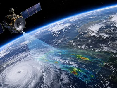
Predictive Frontiers from Observations to AI
Accurately forecasting weather extremes requires a synthesis of high-resolution data and advanced computational models. The predictive challenge lies in capturing both the large-scale dynamics that set the stage and the fine-scale processes that determine local impact.
Modern observation networks, including next-generation geostationary satellites, autonomous profiling buoys, and dense ground-based sensor arrays, provide an unprecedented volume of atmospheric data. This data feeds into ensemble prediction systems that run multiple model simulations with slightly varied initial conditions.
The spread of outcomes within an ensemble offers a crucial measure of forecast uncertainty and enables probabilistic forecasting. This approach is vital for predicting low-probability, high-impact events, moving beyond simple yes/no predictions to quantifying risk. Probabilistic outputs are essential for informed decision-making by emergency managers and policymakers.
Convection-permitting models, which operate at spatial resolutions of one to four kilometers, represent a significant leap forward. These models explicitly simulate deep convective storm clouds rather than relying on parameterizations, dramatically improving the forecast of extreme precipitation localization, mesoscale convective system evolution, and the initiation of severe thunderstorms. Their ability to better rpresent complex topography and land-surface heterogeneity directly enhances predictions for flash flooding and wildfire-prone regions.
Machine learning and artificial intelligence are creating transformative tools for atmospheric science. These systems can identify complex, non-linear patterns within vast historical datasets that traditional methods might miss. A primary application is the post-processing of model output, where AI algorithms learn to correct systematic biases in numerical weather prediction, effectively calibrating raw model guidance to improve accuracy.
Furthermore, AI-driven nowcasting systems use real-time radar and satellite sequences to provide highly accurate, short-term forecasts of storm track and intensity up to a few hours ahead. Perhaps most promising is the development of physics-informed neural networks that incorporate fundamental physical laws into their architecture, ensuring their predictions remain consistent with atmospheric thermodynamics and dynamics while leveraging the pattern-recognition power of AI.
The integration of AI with traditional physics-based models and the burgeoning Internet of Things sensor data presents a frontier for predictive skill. This hybrid approach aims to provide earlier, more reliable warnings for extreme events, from the scale of a city block to entire continents, ultimately closing the gap between predicting the atmosphere's behavior and forecasting its tangible impacts on society.