Eyes in the Sky
Modern meteorology is fundamentally dependent on the continuous global observation provided by satellites. These spacecraft have transformed weather prediction from a localized guessing game into a precise, physics-driven science.
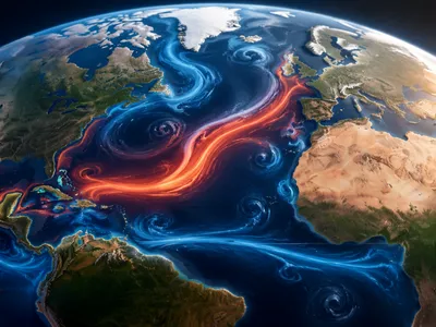
By capturing data from the vantage point of space, they eliminate the vast observational gaps that once existed over oceans, deserts, and poles. This comprehensive coverage is the cornerstone of all reliable atmospheric modeling today.
The evolution of satellite meteorology represents one of the most significant technological advancements in environmental science. It has shifted the paradigm from reactive analysis to proactive, globally-integrated forecasting, enabling predictions that save lives and mitigate economic losses on an unprecedented scale. The data stream from these platforms is the primary input for complex numerical weather prediction models that simulate atmospheric behavior.
From Sputnik to Supercomputers
The journey began with the launch of TIROS-1 in 1960, the first successful weather satellite. Its blurry television images of Earth's cloud cover were a monumental breakthrough, proving the concept of remote sensing from orbit.
This pioneering mission laid the groundwork for the sophisticated geostationary and polar-orbiting fleets we rely on today. Each type serves a distinct and complementary purpose in the global observation network.
Geostationary satellites maintain a fixed position over the equator, providing high-frequency imaging of atmospheric dynamics. In contrast, polar-orbiting satellites circle the Earth, collecting high-resolution data across the entire planet's surface twice daily. This historical progression from simple imagers to advanced sounding instruments created the dense data matrix required by modern supercomputers to initialize forecast models.
The following list highlights key operational satellite families essential for contemporary meteorology:
- Geostationary Operational Environmental Satellites (GOES-R Series)
- Joint Polar Satellite System (JPSS)
- European Meteosat Third Generation (MTG)
- The Chinese Fengyun (FY) constellation
The synergy between these satellite observations and exponential growth in computational power defines the current era. Data assimilation techniques critically blend billions of satellite observations with model forecasts to create an accurate, physically consistent snapshot of the global atmosphere every few hours.
The Orbital Toolkit
Contemporary meteorological satellites are equipped with a sophisticated suite of passive and active remote sensing instruments. Each sensor is designed to capture specific electromagnetic signatures emitted or reflected by the Earth-atmosphere system.
This multi-spectral approach allows scientists to probe different atmospheric layers and surface conditions simultaneously. The raw data from these instruments form the essential inputs for all downstream applications.
The primary instrument categories include imagers, which provide visual and infrared pictures of clouds and storms, and sounders, which are critical for obtaining vertical profiles of temperature and humidity. Advanced microwave radiometers pierce through cloud layers to measure precipitation and sea surface conditions, while atmospheric lidars and radar altimeters deliver precise data on aerosol concentrations and ocean surface topography, respectively.
The synergy between these diverse datasets creates a multidimensional view of the planet. For instance, combining water vapor channel data from an imager with temperature profiles from a sounder allows forecasters to trace the movement of moisture in the upper atmosphere and identify regions of potential instability. This integrated instrument synergy is what transforms simple images into quantifiable atmospheric state variables, feeding the insatiable data requirements of modern assimilation systems. The table below summarizes the core functions of key instrument types.
| Instrument Type | Primary Measurement | Key Meteorological Parameter |
|---|---|---|
| Advanced Imager (e.g., ABI on GOES-R) | Multi-spectral radiance | Cloud track, sea surface temperature, fire detection |
| Infrared Sounder (e.g., CrIS on JPSS) | High-resolution spectral radiance | 3D temperature and humidity profiles |
| Passive Microwave Radiometer | Microwave energy emission | Precipitation rate, total water vapor, sea ice concentration |
| Scatterometer | Ocean surface backscatter | Ocean surface wind speed and direction |
Decoding the Atmosphere's Secrets
Satellite data alone are vast streams of numbers and images. The true breakthrough lies in sophisticated algorithms that convert this raw information into actionable knowledge. This process is known as retrieval or inverse modeling.
Scientists use complex physical and statistical models to invert the observed radiances into geophysical parameters. Each pixel in a satellite image becomes a window into atmospheric composition and dynamics.
For example, by analyzing the precise absorption of infrared radiation at different wavelengths, algorithms can deduce the atmospheric temperature at dozens of distinct pressure levels. Similarly, microwave emissions are sensitive to liquid and frozen hydrometeors within clouds, enabling the estimation of precipitation intensity even over open ocean where ground radar is absent. These retrievals are continually refined using machine learning techniques that identify complex patterns beyond traditional physical models.
One of the most critical applications is the derivation of atmospheric motion vectors by tracking cloud or water vapor features in sequential geostationary satellite images. These wind vectors, especially over data-sparse regions, are invaluable for initializing weather models. Furthermore, hyperspectral sounders provide such detailed chemical fingerprints of the atmosphere that they can track trace gases like ozone, carbon monoxide, and volcanic ash, elevating satellites from mere weather watchers to comprehensive atmospheric chemists monitoring global composition and pollution transport.
Forecasting the Unforeseen
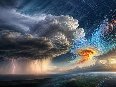
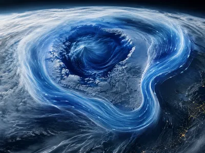
The most vital application of satellite data is in the prediction of high-impact weather events that threaten life and property. The ability to monitor storm genesis in real-time over the open ocean has revolutionized tropical cyclone forecasting. Forecasters can track a storm's eye, analyze its symmetry, and estimate its intensity long before it approaches land.
Similarly, for severe convective storms, satellite-derived stability indices and detailed cloud-top cooling rates provide critical lead time for tornado and severe thunderstorm warnings. This capability is especially crucial in regions with limited ground-based radar coverage.
Beyond tropical and severe weather, satellites are indispensable for predicting atmospheric rivers and associated extreme precipitation that can lead to catastrophic flooding. By measuring integrated water vapor transport across ocean basins, forecast models can predict the landfall of these moisture plumes with increasing accuracy days in advance. The continuous data assimilation fromm polar-orbiting and geostationary satellites corrects and constrains model simulations, reducing the so-called "butterfly effect" of small initial errors. This constant data ingestion cycle is what allows modern ensemble prediction systems to quantify forecast uncertainty and provide probabilistic guidance for extreme events.
The direct integration of satellite radiance data, rather than pre-retrieved products, into numerical models via advanced data assimilation systems like 4D-Var has been a game-changer. It allows the model physics itself to interpret the observations within a dynamically consistent framework, leading to more accurate analyses and, consequently, more reliable forecasts of high-impact phenomena across all time scales, from nowcasting to seasonal outlooks.
Satellites and Climate Science
While vital for daily weather, satellites have become the primary tool for monitoring the long-term heartbeat of the Earth's climate system. They provide the consistent, global, and calibrated observations required to detect and attribute climate change. Unlike sparse ground networks, satellites offer homogeneous coverage of the entire planet.
They track essential climate variables with unparalleled continuity, creating multi-decadal datasets that are free from the biases of urban development or station relocation. This long-term perspective is critical for separating natural variability from anthropogenic trends.
Key satellite climate records include precise measurements of sea surface temperature, which drives ocean-atmosphere interactions; altimetry data revealing the alarming rise in global mean sea level; and lidar observations detailing the health of ice sheets and glaciers. Furthermore, spectrometers meticulously monitor atmospheric concentrations of greenhouse gases like carbon dioxde and methane, providing indisputable evidence of their accumulation. These records form the empirical backbone of climate models and international assessment reports, enabling scientists to project future changes with greater confidence and to validate the performance of their simulations against observed reality.
The following list details some of the most critical long-term climate data records derived from satellites:
- Sea Ice Extent and Thickness Since 1979
- Total Solar Irradiance Since 1978
- Global Land Surface Temperature Since 1981
- Atmospheric CO2 Concentration (from space) Since 2002
The table below contrasts the observational roles of satellites in weather versus climate contexts, highlighting the differing temporal and spatial requirements.
| Aspect | Operational Weather Focus | Climate Monitoring Focus |
|---|---|---|
| Primary Requirement | High temporal frequency (minutes to hours) | Long-term stability and homogeneity (decades) |
| Key Data | Instantaneous atmospheric state, cloud motion | Trends in means, extremes, and Earth system reservoirs |
| Calibration Need | Relative consistency for model assimilation | Absolute accuracy for trend detection |
| Example Metric | Wind vectors for hurricane track | Decadal change in global sea level |
New Ways to Understand the Weather
The next generation of meteorological satellites will be defined by even higher spatial, temporal, and spectral resolution. Upcoming missions aim to shrink the pixel size of observations while dramatically increasing the speed at which the entire globe is scanned.
This evolution will move forecasting from a synoptic scale towards truly convection-allowing global models. Furthermore, the proliferation of small satellite constellations, like CubeSats, promises to fill observational gaps and provide targeted measurements of rapidly evolving storms, offering a more agile and complementary layer to the existing flagship satellite infrastructure.
The integration of artificial intelligence and machine learning represents a paradigm shift in how satellite data is utilized. These technologies are being developed to directly interpret vast streams of raw satellite data, identifying complex patterns and precursors to extreme weather that may elude traditional physics-based algorithms. This approach could lead to faster and more accurate early warning systems. Additionally, the focus on hyper-spectral sounding will yield exquisitely detailed atmospheric profiles, and advanced active sensors like Doppler wind lidars are poised to deliver the long-sought goal of direct global three-dimensional wind measurements from space, a critical missing variable for forecast improvement.