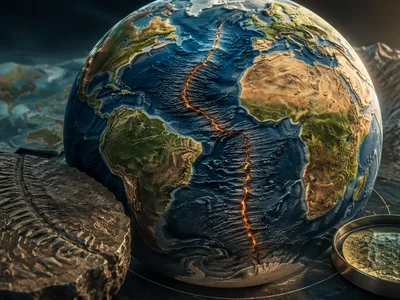
Deciphering Earth's Interior Symphony
Geophysics fundamentally investigates planetary structure by analyzing variations in physical fields like gravity, magnetism, and seismic wave velocities. These fields act as messengers from depths inaccessible to direct observation.
Seismic tomography, analogous to medical CT scanning, uses global earthquake records to construct three-dimensional velocity models of the mantle and core. This technique has revealed large low-shear-velocity provinces (LLSVPs) atop the core-mantle boundary.
The precise nature of these massive thermochemical piles remains debated, but their stability over geologic time suggests they play a crucial role in whole-mantle convection patterns and plume generation. Complementary data from mineral physics experiments at high pressure and temperature allow scientists to interpret seismic velocity anomalies in terms of composition, temperature, and partial melt, transforming abstract seismic maps into constrained thermal and chemical models of the deep Earth.
Geodetic measurements and analyses of the Earth's gravitational field provide another critical lens. Satellite missions like GRACE and GOCE have mapped the geoid and gravity anomalies with unprecedented precision. These data are not simply a map of mass; they reflect the dynamic balance between surface topography and deep density contrasts driven by mantle flow. Interpreting this signal requires computationally inverting for mantle density structure, a process that must account for the viscous relaxation of the mantle over millennia. Gravity data thus uniquely constrain the viscosity and flow strength of the Earth's interior, parameters essential for modeling its long-term mechanical evolution.
- Seismic Tomography: Utilizes earthquake wave travel times to image 3D velocity structure.
- Gravimetry: Measures spatial variations in the gravitational field to infer density distributions.
- Geodynamical Modeling: Combines seismic and gravity constraints to simulate mantle convection processes.
The Dynamics of Plate Tectonics
The theory of plate tectonics provides the unifying framework, but geophysics quantifies the driving and resisting forces. A key question involves the relative contribution of ridge push and slab pull in driving plate motions.
Modern space-based geodetic techniques (GNSS) now measure present-day plate velocities and intraplate deformation directly at millimeter-per-year precision, offering a real-time snapshot of tectonic activity.
These measurements validate and refine kinematic models, revealing that plate motions are remarkably steady over decadal timescales but can exhibit complex, distributed deformation near plate boundaries. Furthermore, the integration of geodetic data with models of seismic strain accumulation across faults allows for improved assessment of seismic hazard, transforming plate tectonics from a historical theory into a predictive, measurable science.
At convergent margins, the process of subduction is probed using seismology to image the geometry of the descending slab and the complex interface with the overriding plate. Magnetotelluric surveys, which measure subsurface electrical conductivity, often reveal partial melt and fluid release from the slab, crucial for understanding arc volcanism. The resistive strength of plates, particularly the stability of cratonic roots, is investigated through combinations of seismic anisotropy studies and thermo-mechanical modeling, probing why some continental cores have survived billions of years of convective mantle forcing.
The following table summarizes key forces and the primary geophysical methods used to study them:
| Tectonic Force | Geophysical Manifestation | Primary Investigative Method |
|---|---|---|
| Slab Pull | Deep seismic zones, mantle velocity anomalies | Seismic Tomography |
| Ridge Push | Elevated topography, predictable gravity signal | Satellite Gravimetry |
| Mantle Drag | Basal shear stress, plate motion correlation | Geodynamic Inversion |
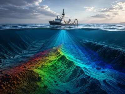
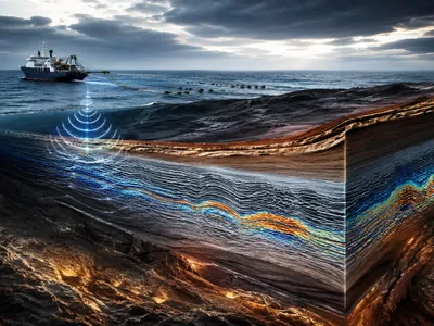
Seismology: Imaging Subsurface Structures
Modern seismology transcends the mere location of earthquakes, employing engineered signals and ambient noise to image Earth's interior with startling clarity. Advanced computational techniques transform seismic wave arrival times into detailed three-dimensional velocity models, revealing concealed geologic structures.
These models distinguish between solid rock, fluid-saturated sediments, and partial melt, acting as a direct probe into crustal composition and mechanical state. The resulting velocity maps are foundational for resource exploration and tectonic hazard assessment.
A transformative innovation is ambient noise seismology, which utilizes the continuous, low-energy vibrations from ocean waves, wind, and human activity. By applying seismic interferometry to recordings from different stations, the ambient wavefield can be used to construct virtual seismograms, effectively turning one station into a seismic source for another. This method allows for high-resolution monitoring of seismic velocity changes over time, detecting subtle perturbations on the order of 0.01% that signal variations in crustal stress, groundwater levels, or volcanic pressurization.
Research on active fault zones demonstrates that these subtle velocity variations are often tidally modulated. Studies of the Anninghe fault in China, using dense seismic arrays, have captured periodic seismic velocity changes at diurnal and semidiurnal frequencies, synchronized with Earth tides. The fault fracture zone exhibits a significantly stronger response than surrounding bedrock, attribted to tidal forces modulating the opening and closing of cracks and pores within the damaged rocki This sensitivity confirms that fault zones are dynamically coupled to regional stress fields, with tidal forces providing a natural, periodic stress probe to investigate fault mechanical properties.
The following table outlines key seismic methods and their primary applications in subsurface imaging:
| Method | Principle | Primary Application |
|---|---|---|
| Active-Source Seismics | Controlled explosive or vibratory sources | High-resolution crustal mapping, resource exploration |
| Passive Seismic Tomography | Natural earthquake waves | Large-scale lithospheric and mantle imaging |
| Ambient Noise Interferometry | Cross-correlation of continuous seismic noise | Temporal velocity monitoring, shallow subsurface imaging |
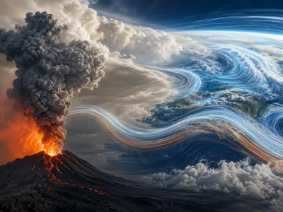
Monitoring Volcanic and Hydrothermal Systems
Geophysics provides essential tools for deciphering the hidden dynamics of volcanoes, integrating multiple parameters to assess unrest and eruption likelihood. No single parameter is diagnostic; instead, the convergence of signals builds a reliable forecast.
Ground deformation, measured by InSAR (Interferometric Synthetic Aperture Radar) and GNSS networks, is a direct indicator of subsurface magma movement. Inflation signals magma accumulation, while deflation may indicate eruption or drainage.
The character of seismic signals is equally critical. Volcano-tectonic earthquakes signify brittle rock failure, while long-period earthquakes and harmonic tremor are linked to fluid movement and resonance within conduits. The transition between these seismic families often heralds an impending eruption.
Gravity monitoring adds a crucial dimension by detecting mass change. A volcano inflating without a proportional increase in mass suggests pressurization of existing magma, whereas inflation with added mass indicates new magma intrusion. This multi-parameter synergy is the cornerstone of modern volcanic hazard assessment.
Hydrothermal systems, whether volcanic or tectonic in origin, are also effectively monitored through geophysical means. Magnetotelluric surveys image subsurface electrical resistivity, which plummets in the presence of saline fluids and molten rock, outlining hydrothermal reservoirs and magma bodies.
Self-potential and microgravity surveys track fluid flow and mass changes associated with geothermal production. Furthermore, the ambient seismic noise techniques used in fault monitoring are equally applicable here, with studies showing that groundwater fluctuations in coastal aquifers driven by tidal forcing can be detected through temporal changes in seismic velocity and site resonance frequencies. This establishes a geophysical link between surface tidal cycles and subsurface hydrogeological processes.
- Ground Deformation (InSAR, GNSS): Tracks magma migration and reservoir pressure changes.
- Seismic Monitoring (Earthquakes, Tremor): Identifies rock failure and fluid movement signatures.
- Geoelectrical & Gravimetric Methods: Maps fluid reservoirs and detects subsurface mass transfer.
Geophysical Frontiers in Climate Science
Geophysical methods are increasingly pivotal in quantifying and attributing the physical changes driven by a warming climate, providing essential baseline data and monitoring capabilities.
The cryosphere is a critical focus, with radio-echo sounding and airborne radar mapping the internal layers and basal conditions of ice sheets. These data reveal ancient climate archives and identify regions of rapid melt.
Satellite altimetry and time-variable gravity measurements from missions like GRACE and GRACE-Follow On directly measure ice sheet and glacier mass loss, translating volume change into gigaton-scale contributions to sea-level rise. The precision of these observations has transformed our understanding of cryospheric dynamics, moving from estimates to direct, quantitative measurements of Earth's changing mass balance.
Beyond the cryosphere, geophysical techniques monitor terrestrial water storage, a key component of the hydrological cycle often missing from point-scale measurements. Time-lapse gravimetry from space detects changes in aquifer levels and soil moisture across continental scales, while advances in seismic interferometry allow the use of ambient noise to monitor groundwater fluctuations in watersheds. This capability is vital for assessing water resource vulnerability and understanding the full spectrum of sea-level rise contributors, which includes the mass transfer of pumped groundwater to the oceans. The integration of disparate geophysical datasets is essential for closing the global sea-level budget.
Furthermore, geophysics probes the complex feedback between permafrost thaw and the carbon cycle. Electrical resistivity tomography and seismic surface wave methods map the active layer thickness and detect the presence of thawed sediments and taliks. These subsurface images are correlated with greenhouse gas flux measurements to determine how geologic setting, ice content, and hydrological pathways control the release of carbon dioxide and methane. Geophysical characterization is therefore critical for constraining the magnitude and timing of this potentially major climate feedback. The field is also advancing in its ability to directly monitor atmospheric composition through differential absorption lidar and other remote sensing techniques, bridging the gap between solid Earth processes and atmospheric science.
The application of key geophysical tools to climate science challenges is summarized below:
| Geophysical Tool | Climate System Target | Measured Parameter |
|---|---|---|
| Satellite Gravimetry (GRACE) | Ice Sheets, Aquifers | Time-variable mass change |
| Ice-Penetrating Radar | Ice Sheets & Glaciers | Internal structure, basal hydrology |
| Seismic & Resistivity Methods | Permafrost | Active layer thickness, thaw state |
| InSAR | Coastal Subsidence | Land surface deformation |
Looking ahead, the frontier involves integrating these diverse measurements into coupled process models. For instance, satellite-derived crustal uplift data from past ice melt are used to refine models of glacial isostatic adjustment, which must be accurately accounted for to isolate modern ice mass signals. Similarly, combining seismic images of permafrost structure with thermal models improves predictions of future thaw. This integrative, physics-based approach is what positions geophysics as a cornerstone of actionable climate science.